
Spectral mixture analysis for water quality assessment over the Amazon floodplain using Hyperion/EO-1 images
Resumen
Water composition undergoes complex spatial and temporal variations throughout the central Amazon floodplain. This study analyzed the spectral mixtures of the optically active substances (OASs) in water with spaceborne hyperspectral images. The test site was located upstream the confluence of Amazon (white water) and Tapajós (clear-water) rivers, where two Hyperion images were acquired from the Earth Observing One (EO-1) satellite. The first image was acquired on September 16, 2001, during the falling water period of the Amazon River. The second image was acquired on June 23, 2005, at the end of the high water period. The images were pre-processed to remove stripes of anomalous pixels, convert radiance-calibrated data to surface reflectance, mask land, clouds and macrophytes targets, and spectral subset the data within the range of 457-885nm. A sequential procedure with the techniques Minimum Noise Fraction (MNF), Pixel Purity Index (PPI) and n-dimensional visualization of the MNF feature space was employed to select end-members from both images. A single set of end-members was gathered to represent the following spectrally unique OASs: clear-water; dissolved organic matter; suspended sediments; and phytoplankton. The Linear Spectral Unmixing algorithm was applied to each Hyperion image in order to map the spatial distribution of these constituents, in terms of sub-pixel fractional abundances. Results showed three patterns of changes in the water quality from high to falling flood periods: decrease of suspended inorganic matter concentration in the Amazon River; increase of suspended inorganic matter and phytoplankton concentrations in varzea lakes; and increase of phytoplankton concentration in the Tapajós River.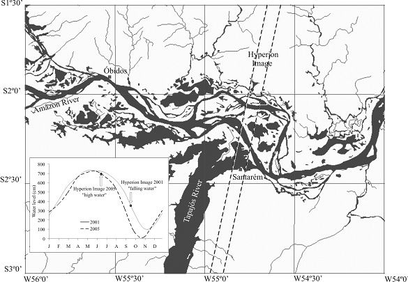
Publicado
06/06/2007
Número
Sección
Articulos
Authors maintain the copyrights for their work. However, they grant rights of first publication to Ambiente e Agua - An Interdisciplinary Journal of Applied Science. In compensation, the journal can transfer the copyrights, allowing non-commercial use of the article including the right of sending the article to other data bases or publication media. La revista utiliza la licencia CC BY 4.0"
